Province to reverse mandated urban boundary changes


WELLINGTON COUNTY – A controversial provincial decision to unilaterally move rural properties into urban boundaries, both here and across the province, will be reversed.
At an Oct. 23 press conference, Municipal Affairs and Housing Minister Paul Calandra announced legislation will be introduced to reverse recent urban boundary changes made by the province to Official Plans for the cities of Barrie, Belleville, Guelph, Hamilton, Ottawa and Peterborough, the regions of Halton, Niagara, Peel, Waterloo and York and the County of Wellington.
The government says the changes will be undone, except in circumstances where construction has begun, or where doing so would contravene existing provincial legislation and regulations.
When announcing the reversal, Calandra said he had been reviewing past Ministry of Municipal Affairs and Housing decisions to ensure they were made in a “manner that maintains and reinforces public trust.”
He said the changes made to urban boundaries “failed to meet that test,” stating there was “too much involvement from the minister’s office.”
Local changes
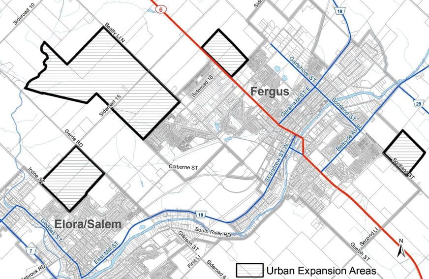
On April 11 the provincial government made unilateral modifications to an amendment to Wellington County’s Official Plan, adding more than 1,000 acres of mostly agricultural land to urban boundaries.
The boundary extensions, which were among modifications directed in the Ministry of Municipal Affairs’ approval of Official Plan Amendment (OPA) 119, included:
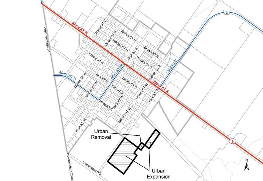
- just over 1,000 acres around Fergus and Elora in Centre Wellington;
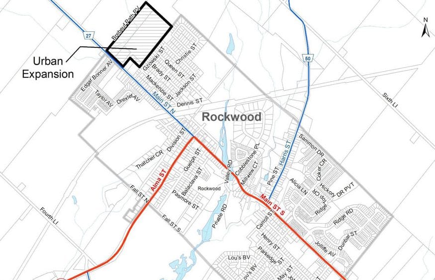
- 37 acres adjacent to Rockwood in Guelph/Eramosa; and
- about 15 acres on the southwest corner of Clifford in Minto.
At the time, Centre Wellington Mayor Shawn Watters called the inclusion of one newly identified area, north of Fergus on Beatty Line straddling Sideroad 15 all the way up to Irvine Creek, a “curious” decision by the province.
Guelph/Eramosa Mayor Chris White said his municipality did not have the sewage capacity to support the Rockwood expansion.
And Minto Mayor Dave Turton said a developer had requested urbanization of the 15 acres brought into Clifford under OPA 119, while the municipality was “recommending expansion in other parts of Minto.”
The moves became increasingly controversial in recent weeks, as larger municipalities, notably Hamilton, began pushing back against the forced urban boundary changes.
[related]
Ontario’s official opposition, the New Democratic Party, asked the auditor general’s office on Sept. 29 to launch an investigation into the urban boundary expansions.
The NDP claimed preferential treatment was given, against the wishes of some affected municipalities, to some of the same developers that stood to benefit from a Nov. 24, 2022 decision to remove 2,994 hectares from the Greenbelt, while adding 3,804 hectares in other locations, including the Town of Erin.
Premier Doug Ford ultimately reversed his Greenbelt plan after both the province’s auditor general and the integrity commissioner released reports concluding the process favoured certain developers.
The RCMP has since launched a criminal investigation into the Greenbelt affair, which has so far resulted in the resignation of two cabinet ministers, including former housing minister Steve Clark, and several high-level government staff members.
Wellington County Warden Andy Lennox said the county had not yet officially joined some other affected municipalities in reaching out to the province to protest the boundary changes.
“We’ve been working through some informal channels, but we hadn’t got around to that, although others have been working at it and we were aware of that,” said Lennox, who told the Advertiser he was surprised at how quickly the decision was reversed.
“I was surprised by the speed and how soon it came. I’m not surprised that it came eventually, but it’s quite encouraging.”
Lennox added, “I think it is a good move towards orderly development that matches what we can service and look after for our communities.
“I think giving us back some local control is absolutely a positive thing.”
Recent sale in Centre Wellington
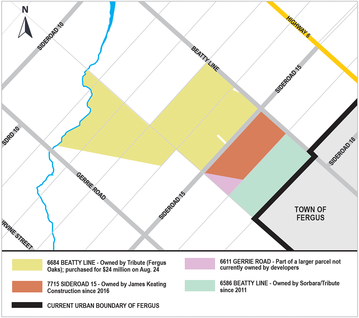
The reversal throws into question the future of a piece of Centre Wellington farmland that was sold to a developer after being brought into the Fergus urban boundary through the April 11 decision.
The Advertiser has confirmed through Ontario Land Registry records that a 370-acre parcel of land at 6684 Beatty Line was sold by Drost Cattle Company to Tribute (Fergus Oaks Ltd.) for $24 million in a deal that closed on Aug. 24.
The newspaper had reached out last week to officials at the Pickering head office of Tribute Communities, which developed the Storybrook subdivision in Fergus in association with Vaughan-based Sorbara Group, for information on plans for the Beatty Line property, but received no response to several emails.
Following the province’s Oct. 23 announcement at a 10am press conference, Tribute director of land development Susan Zucchero declined to comment on the province’s reversal of the urban boundary changes.
“There’s no comment to be given to the press at this time. It’s something fairly recent,” said Zucchero when reached by the Advertiser on Monday afternoon.
Zucchsero acknowledged she was aware of the purchase of the Drost property, but also declined to respond to questions about plans for developing it.
“I haven’t started even looking at the project,” she said.
The $24-million purchase price of the Fergus area property puts it close to $65,000 an acre, significantly higher than typically paid for farmland in the region.
Statistics Canada data indicates farmland across Ontario was valued at just over $17,000 an acre as of July 1, 2022, while data from the Farm Credit Corporation pegged the average price at around $26,000 an acre last year for land in southwestern Ontario.
Since the local boundary changes were mandated, Wellington Federation of Agriculture (WFA) officials have expressed concern that urbanization of prime agricultural could push prices out of the reach of many farmers.
“With some of this boundary expansion that’s happening, if they can turn around and sell their land for significantly more than it’s worth as agricultural land, it really puts them in a position where they really can’t say no,” WFA president Janet Harrop stated during a Sept. 28 delegation to Wellington County council.
Lennox said it’s too early to say what will happen with the local farmland Tribute purchased once it’s removed from the urban boundary via the promised legislation.
“I can’t weigh in on that specifically … I think we’ll await the details from the province before we convene the celebration completely,” he said.
“But, yeah, there’s some stuff to sort out here.”
Officials at lower tier municipalities were also cautious in their initial response to the province’s latest flip-flop on housing policy.
“Until we hear from the province on how this decision will specifically affect Centre Wellington, we will continue to work with all levels of government and facilitate integrated planning for growth in our community,” stated township spokesperson Kendra Martin in an email.
Other Centre Wellington properties
The decision also impacts other lands urbanized by the province on April 11.
Land registry records indicate much of the impacted land along Beatty Line near Fergus was already owned by developers, although not in the urban boundary prior to April 11.
A 110-acre property at 6586 Beatty Line, just past the existing urban boundary, was purchased by a company listed as Sorbara/Tribute Brubacher Holdings Inc. in 2011.
Since 2016, an 86-acre parcel of land at 7715 Sideroad 15 has been owned by local developer James Keating Construction.
The three parcels comprise virtually all of the land brought into the urban boundary north of Fergus along Beatty Line, except for two small pieces that were severed (one each on Sideroad 15 and Beatty Line) and a triangular-shaped parcel at 6611 Gerrie Road.
Decision-making 'handed back'
Now it appears local municipalities will have a say in whether those lands will eventually be urbanized, and how the process will work.
“I just think it’s positive … our local decision-making is being handed back to us,” Lennox said. “I mean, we’re all on the same team here in terms of trying to get housing built for our residents.
“But I think it can probably be facilitated more easily with us making sure that it matches with our capability to service the lands.”
The changes have also impacted the workload for municipal planners in affected municipalities.
County staff, for example, were in the midst of a Municipal Comprehensive Review which also involves determining where municipal boundaries can be expanded to facilitate growth, when the province announced the Official Plan modifications.
Lennox said he is hopeful the province may reimburse municipalities for some of the costs associated with accommodating the changes.
“I think in their announcement, (the province) made recognition of that, that there may be some costs associated with staff time as well. So that also was positive,” said Lennox.
Minto
“The Town of Minto has had no communication with the province in reference to that property in Clifford,” Mayor Dave Turton told the Advertiser when reached on Monday afternoon.
“If for some reason it does stay as is, and it does go ahead with new homes, new streets, we do have the capacity in our wastewater treatment plant, and our water, so it’s not going to affect us that much.
“But, if the province does make a change, then we’ll deal with that at that time.”
Guelph/Eramosa
Mayor Chris White said he is “happy” with the province’s reversal in Guelph/Eramosa.
“I think it’s fantastic news,” he told the Advertiser on Oct. 24.
An application for the additional 37 acres in Guelph/Eramosa, located near the fire hall and police station at the northern entrance to Rockwood, indicates a plan for “three or four hundred homes,” White previously stated.
However, the City of Guelph provides wastewater services for Rockwood and once already-approved developments in the village are complete, the township’s capacity will be depleted.
White said township officials have previously informed the owner of the land, which is still zoned prime agricultural, about those restrictions.
“The bottom line is we don’t have the sewage capacity anyway … but the whole problem with this thing was they never spoke to us,” he said on Tuesday.
“You can’t just unilaterally start dropping housing all over the place.”
White said while nothing is yet confirmed, he is hopeful the previous Rockwood urban boundary is restored “and we’ll see how that looks when it happens.”
-With files from Joanne Shuttleworth and Chris Daponte