


GUELPH – At Glen Allan Park, at the edge of Mapleton Township and Wellington County’s boundary, you’ll find a swingset, slide, some picnic tables under a pavilion, and an old bridge—its former roadway now covered over by grass.
That this area was once home to over 1,500 formerly enslaved Black people who settled on the land and farmed it in the 19th century could have been completely lost on visitors if it weren’t for an Ontario Heritage Trust plaque adjacent to the park’s playset – and a new mapping project recently launched by the Guelph Black Heritage Society (GBHS).
Those early Black settlers came to the area beginning in 1820, clearing the land of trees and brush to construct schools and churches. They laboured and toiled to establish a community that came to be known as the Queen’s Bush Settlement.
Around 20 years later, the government of the day forced those same people to leave if they couldn’t pay up.
And so it was in 1850 that many Blacks, unable to purchase the land they worked to clear and establish, began migrating across Ontario from the Queen’s Bush.
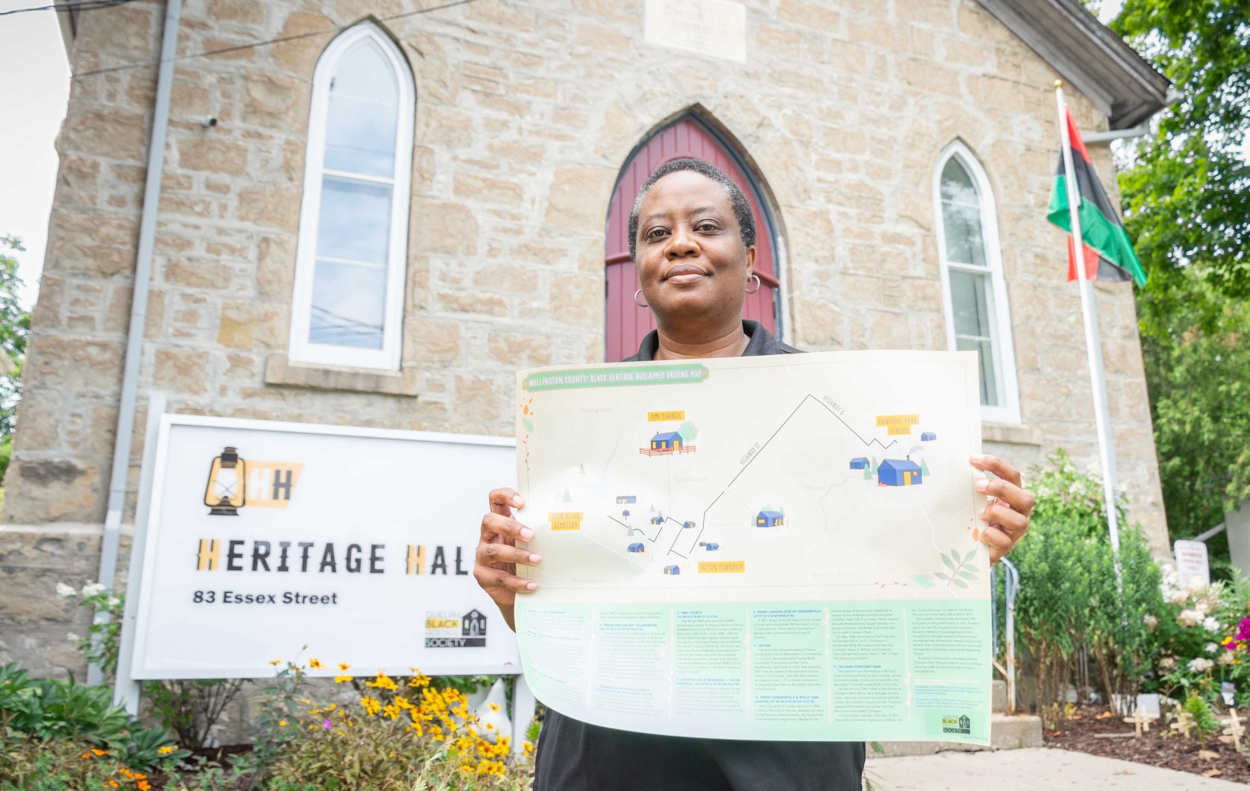
This slice of local Black history appears, along with 10 other landmarks, on a new map released by the GHBS on Aug. 9.
The 15-by-20 inch map begins and ends at two areas of great significance to the society and the Black community: Glen Allan Cemetery, where Black families are buried, and at Pierpoint Park in Fergus, where Richard Pierpoint, thought to be one of Canada’s earliest Black settlers, was granted 100-acres of land along the Grand River.
The map is intended to be used for a self-guided journey across the county, from Wallenstein to Fergus, with text below the locations (some with coordinates) containing small histories.
Though buildings and physical clues no longer remain, replaced by parks or cornfields, it’s their absence that causes travellers retracing the steps of Black settlers to imagine what once stood at the locations.
“We want people to stop, think and remember,” said GBHS president Denise Francis.
“The absence of these places of significance is just as important as the physical places that we can go to now.
“It’s still important for us to remember and acknowledge them.”
Where the journey ends—Pierpoint Park is location 11 on the map—is really where the journey for the project began, with research into locations of Black significance throughout the county around a year ago.
The heritage society partnered with the University of Guelph’s Community Engaged Scholarship Institute and PhD student Wencke Rudi, who made a deep-dive through historical archives.
Francis says many think of Black history as something lying beyond our borders, giving attention to Black American figures such as Martin Luther King Jr. and Rosa Parks, but Black heritage is very much local, and in abundance—Rudi eventually turned up 40 locations of Black significance.
The locations for the current map were chosen based on accessibility, but another map is currently in the works, expanding on the collaborative work to include locations in the county and Guelph.
In addition to the forthcoming map, the society is also working with London-based Exar Studios to create an audio tour, made possible through a downloadable smartphone app, with one- to two-minute recordings about the history of each location.
A release for the first portion, focusing on the Heritage Hall at 83 Essex Street, in Guelph, is anticipated for the fall.
“We’re always talking about the absence and erasure of Black history in Guelph and Wellington County and Canada in general, and we wanted to try and start creating some tangible resources that our community could have,” Francis said.
She added the “passion project” is “something that feeds our souls.”
The society has been “overwhelmed” by community interest so far, Francis said.
A day after releasing the map, another order was placed for 100 more copies.
“It shows that there is a desire and there is a thirst for this knowledge about our community, simply because it’s so hard to find,” Francis said.
“We are so happy the community has embraced this project.”
Maps are available for purchase at guelphblackheritage.ca/product/wellington-county-black-heritage-reclaimed-driving-map.